The Mount Amiata (Monte Amiata in Italian) is an extinct volcano in the Apennines, which culminates in southern Tuscany at 1,733 metres, between the Maremma to the west and the valleys of Val d’Orcia and Val di Chiana to the east, close to Umbria and Lazio. The eight municipalities in its territory are part of the province of Grosseto and part of the province of Siena.
Territory and nature
The now extinct Amiata volcano has forged a territory with strong character, the origin of tuff rocks and fertile land, rich in mushrooms, chestnuts or olives. Water is another prominent feature of the mountain, with on one hand the spring from Santa Fiora, and on the other hand the warm waters that feed the thermal baths at Bagni San Filippo, Not to mention the snow in winter that covers the heights.
You can enjoy the spring to fall of its trails, on foot, by bike or on horseback. There are several nature reserves (including the Mount Labbro, the Amiata Wildlife Park and the WWF Bosco Rocconi oasis).
Among the 210 km of marked trails the most famous is the “ring of Amiata” (30 km around the mount).
In winter you can go snowshoeing, and a small ski resort has 8 lifts and 10 km of slopes.
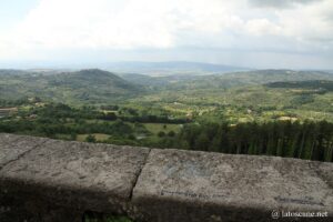
Whatever the season, from the summit you can admire a magnificent panorama towards the Sienese countryside and that of the Maremma of the province of Grosseto. There is a monumental iron cross 22 meters high.
Indiana Park and adventure park, the Nature Trail along the Onazio River and the gorge. Many trails suitable for mountain biking, speleology sites, with the cave of Sassocolato or Bacheca, inside the nature reserve of Mount Penna.
If you see this after your page is loaded completely, leafletJS files are missing.
Villages
Abbadia San Salvatore
Abbadia San Salvatore took its name from the Abbey of San Salvatore, which for more than a thousand years housed the famous Amiatina Bible. In addition to the abbey and the museum of sacred art, there is the Mining Museum.
→ Read also the page on Abbadia San Salvatore
Piancastagnaio
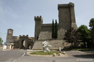
Near the border with the province of Viterbo in Lazio, Piancastagnaio has a charming medieval historic heart that can be reached by the mighty castle of the Aldobrandeschi.
→ Read also the page on Piancastagno
Santa Fiora
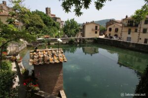
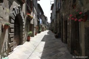
One of the most beautiful villages in Italy, Santa Fiora has various qualities. First with the historic center of the Castello district around Piazza Garibaldi with the beautiful palaces and the clock tower, or the old church from the twelfth century. Next and above all, below in the district of Montecatino the Peschiera is an enchanting site, with a large pool fed by the source, and the park-garden.
→ Read also the page on Santa Fiora
Arcidosso
Arcidosso is the capital of the Union of Municipalities Amiata Grossetano, where live nearly 4500 inhabitants.
The pretty village is dominated by the Castle Aldobrandesco (of the family that controlled the city from 12th to 14th in 1331 when it fell after a siege of Siena) dating back to the year mile, around which it developed.
In its historical centre on top of a relief the church San Niccolò is the oldest in the locality. Towards Castel del Piana is the Capuchin Convent, and to the south the Tibetan temple Gompa di Merigar West on Mount Labbro.
Castel del Piano
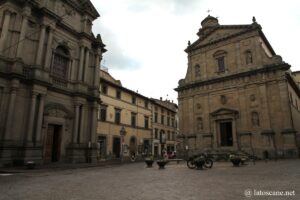
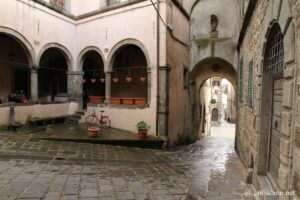
With nearly 5,000 inhabitants, Castel del Piano is the most populated of the municipalities on Mount Amiata. In the center, there are Piazza Madonna near the Porta dell’Orologio the church of the Propositura, and the beautiful church of Santa Maria delle Grazie. Its 13th-century walls are quite well preserved, with three beautiful doors to access the narrow streets of the historic centre.
Seggiano
The smallest of the municipalities of Mount Amiata, on its hill Seggiano has a pretty historic center, including old churches (the Oratory of San Rocco with its quality frescoes), defensive walls and doors.
Its reputation is linked to the cultivation of olives, with its special species Olivastra Seggianese and its famous and tasty oil. One of its olive trees, very old, is in the center, the roots hanging in the old cistern. You can also see the old press and oil mill renovated for the visit. We also mention the garden of Daniel Spoerri.
Where is Mount Amiata, map
If you see this after your page is loaded completely, leafletJS files are missing.
Links and sources
- General informations: en.wikipedia.org
- Tourist portals and others: www.agriturismoverde.com, www.visittuscany.com
Articles about Monte Amiata
- Abbadia San Salvatore, village of Mount Amiata
 Abbadia San Salvatore is a characteristic village of Mount Amiata, the closest to the summit, at 800 meters altitude on the eastern side of the mountain. It is thus a ...
 - Bagni San Filippo and Vivo d’Orcia
 Bagni San Filippo On the eastern slopes of Mount Amiata, bordering the Val d’Orcia, Bagni San Filippo is a thermal village whose waters have been known since antiquity. Its hot, therapeutic ...
 - Santa Fiora in Tuscany
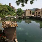 On the southern slopes of Mount Amiata, Santa Fiora overlooks the source of the Fiora River. This village is a little special in its history, having been an important possession ...
 - Piancastagnaio in Tuscany
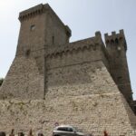 Piancastagno is an ancient village of medieval origin on the slopes of Mount Amiata, perched on a ledge overlooking the valley of the Paglia and the Cassia.Its origin dates back ...
No Comments Yet